Show Mountain Information through the Camera.


All Peaks whithin 10 miles.
The Peaks whitch higher than 10,000 feet. whithin 20 miles.
The Peaks whitch higher than 13,000 feet. whithin 50 miles.
Not only current location, Any location specified in the center of the Map.
You can be around the world.
Camera button of the AR View Taken Screenshot, and you can save the album, or post to the SNS.
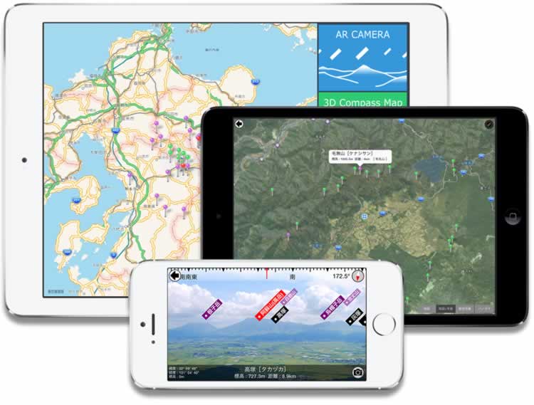
Map which is linked to the compass can be displayed In the mountains of 10miles within.
iPad can display the map in the panorama.
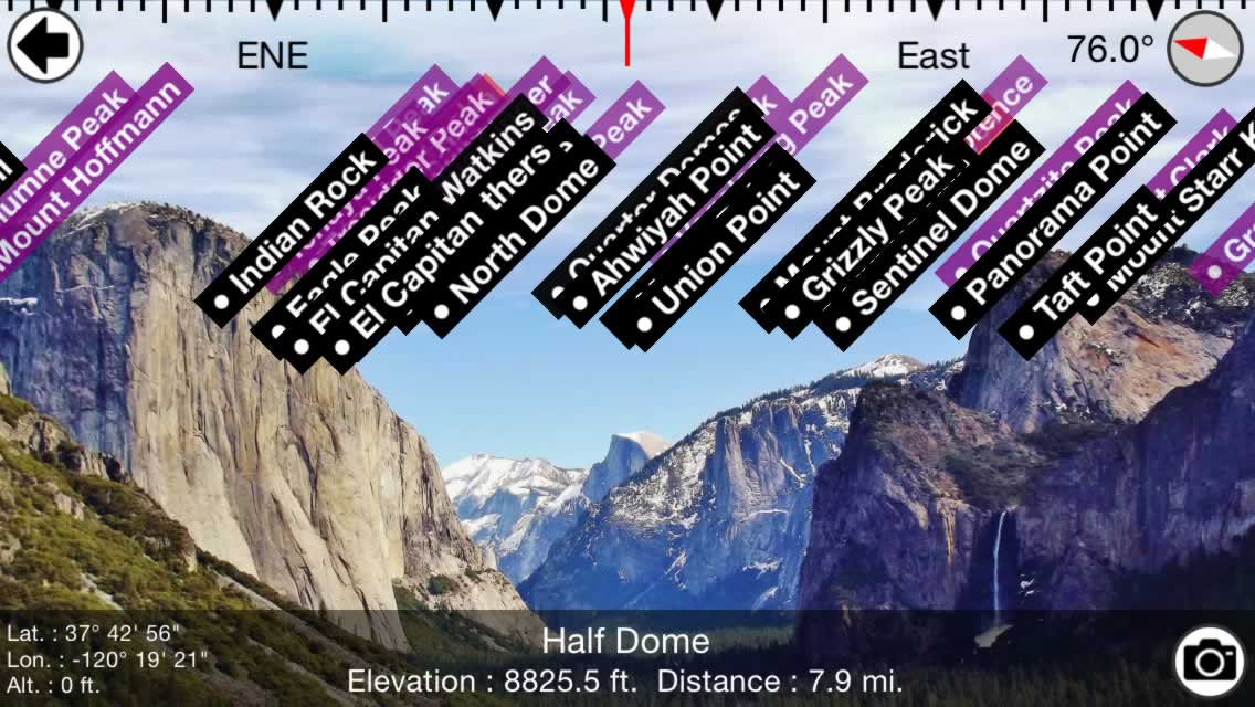
This is an application which shows the names of hills and mountains superimposed over the camera view.
Look at the landscape using the camera and labels are superimposed directly over the view. The labels can show the distance to the mountain peak, the bearing, and the height of the mountain.
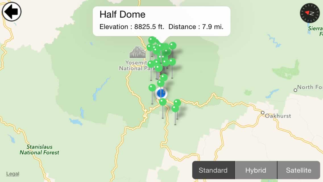
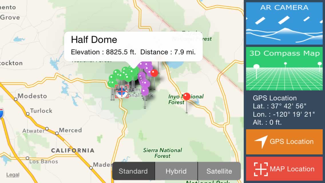
You can also take a look at your position and mountains positional relationship on the map.
In the primary view, will be pinned on the mountain within around 10 miles a map.
Please know the mountain positional relationship of the map of zoom and drag.
Mountain of information when you tap the pin you can see.
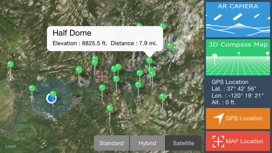
Not only the current location, which is positioning in GPS, you can have the information display in the center of the map that you specify in any.
Please tap the "MAP location" button Move the location where you want to appear in the center point of the map.
If you tap the "GPS location" button, to return to the display of the current position.

I am equipped with a manual compass function. Tap the compass button (or double-tap the AR area) to switch to the automatic-manual of the compass.
During manual compass, you can freely set the direction by dragging the AR area to the left and right.
Please tweak when the shift occurs in the automatic compass.
Tap the camera button, you can AR screen shooting as it is the screen shot.
The captured photo, you can save the album in the dialog, you can post to SNS you are using.
Compatible with iOS and Andoroid devices.
iOS 7.0 or later.
Android 2.3.3 or later
Requires WiFi, Edge, or 3G network connection sometimes required.
If you have any such questions or problems, please contact us from here.